
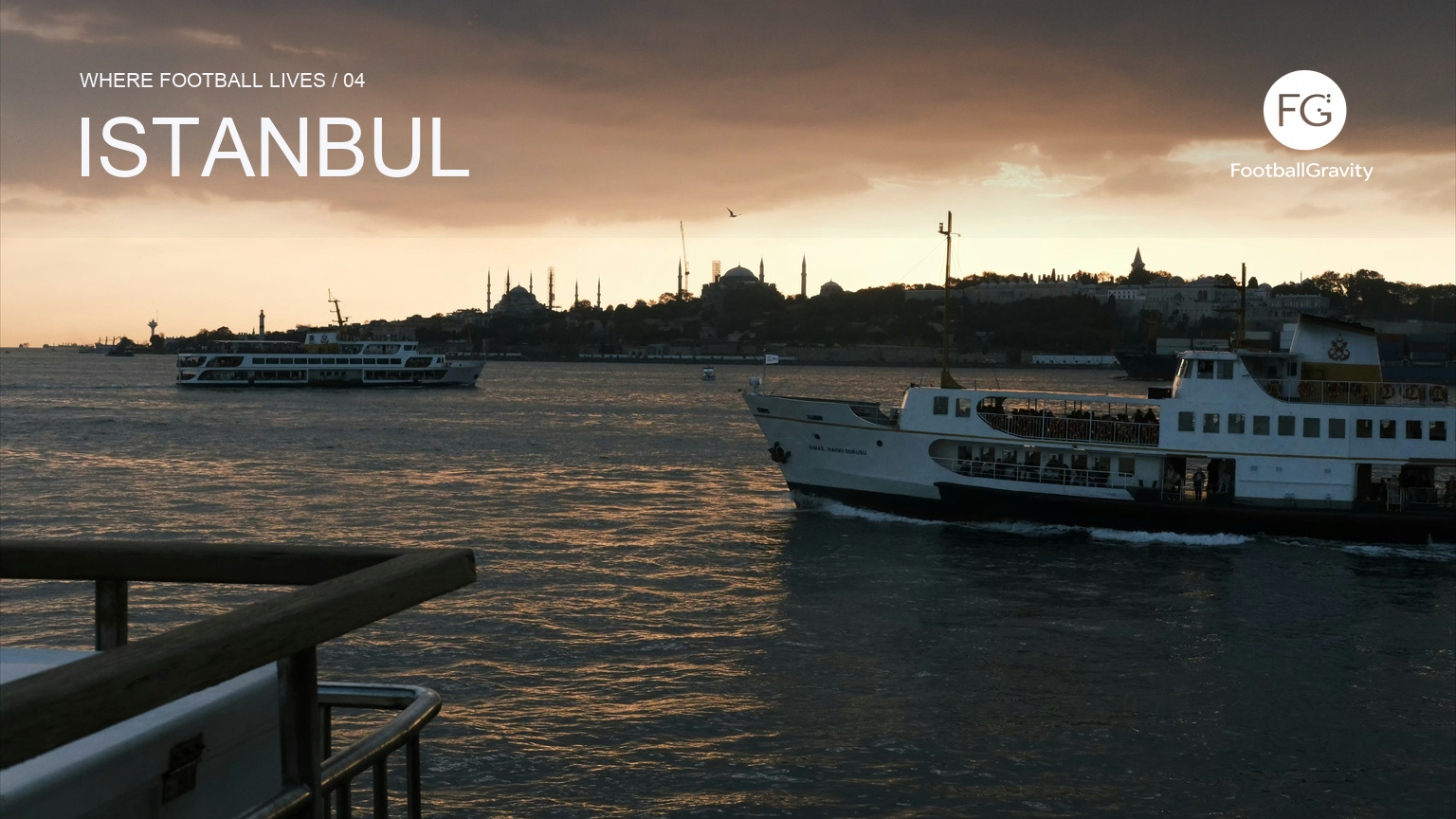
Where Football Lives / 04. In Istanbul, football belongs to districts, shorelines and routes across the water. To understand the clubs, it helps to begin with the journey between them.
A ferry from Kadıköy to Beşiktaş does more than carry passengers from the Asian side of Istanbul to the European side. It joins two places whose names also belong to football clubs. The municipal ferry operator lists Kadıköy–Beşiktaş among the city’s regular inner routes, alongside crossings to Karaköy, Eminönü, Kabataş and the Golden Horn. For residents, the Bosphorus is part of the transport system before it becomes a view.
That distinction matters in a football city often introduced through spectacle. Istanbul can supply the grandest possible frame: water, hills, minarets, bridges and a population spread across two continents. Yet its clubs become more legible at district level. Fenerbahçe grew from Kadıköy and still plays there. Beşiktaş shares its name with the district around its waterfront home. Galatasaray began in a school in Beyoğlu and now stages its matches farther north at Seyrantepe.
These are not three versions of the same club. Their histories, institutions and supporter cultures should not be compressed into a visitor’s checklist of rivalries. What they share is a city whose geography makes belonging visible. A football day can involve a ferry, a metro branch, a funicular, a walk down a hill or a return across the strait after dark. The route is part of the club’s address.
A crossing built into ordinary life
Istanbul Metropolitan Municipality describes a city divided administratively into 39 districts and geographically into European and Anatolian sides. The water between them is substantial enough to organise daily movement, but too connected to function as a simple border. Ferries cross it repeatedly. Rail lines pass beneath it. Bridges carry road traffic above it. People change continents as part of an ordinary commute.
Football follows that pattern. The Şehir Hatları timetable includes direct Kadıköy–Beşiktaş services and routes linking Kadıköy with Karaköy, Eminönü and Kabataş. Metro Istanbul’s network adds another layer: the M4 begins at Kadıköy, while the M2 runs from the historic peninsula and central European districts towards Seyrantepe. The city does not need a special football transport map. Its everyday network already connects several of the places that give the game its identity.
This makes the Bosphorus useful without turning it into an easy metaphor about a city “between East and West”. The crossing is physical and practical. It changes where a supporter starts, how long the day takes and which part of Istanbul remains in view on the way to the match. The clubs belong to a transcontinental metropolis, but they are rooted in particular streets and institutions.
Fenerbahçe: the district remains in the name
Fenerbahçe offers the clearest link between club and local geography. The club was founded in 1907 by young men from Kadıköy and took its name from the Fenerbahçe neighbourhood and peninsula. Its early emblem referred to the lighthouse at Fenerbahçe Cape. The present stadium occupies the same part of Kadıköy where organised football was played in the early years of the game in Istanbul.
The current sponsored name is Chobani Stadyumu Fenerbahçe Şükrü Saracoğlu Spor Kompleksi. Sponsorship may alter the wording used in fixtures and broadcasts, but the setting remains Kadıköy. The M4 metro line begins nearby, suburban rail serves Söğütlüçeşme, and the ferry piers connect the district with the European shore. A home match therefore sits within a transport centre, a shopping area, residential streets and a waterfront district that continues to function beyond football.
For an outsider, the important point is not to treat the Asian side as an excursion away from the “main” Istanbul. Kadıköy is one of the city’s major centres in its own right. Fenerbahçe’s history makes that local confidence part of the club’s name. Arriving by ferry can clarify the scale of Istanbul, but arriving at Kadıköy should also correct the idea that everything across the water is peripheral.
Beşiktaş at the water’s edge
On the European shore, Beşiktaş presents a different form of proximity. The club dates its foundation to 1903 and began as a multi-sport institution. Its stadium address is in Vişnezade, within Beşiktaş district, beside the Dolmabahçe area and close to the Bosphorus. Few large grounds occupy such a visible place in a city’s central landscape.
The old İnönü Stadium opened in 1947. Beşiktaş demolished it after the 2012/13 season and built the present ground on the same site. The replacement staged its first match in April 2016. The club lists the Tüpraş Stadyumu as a 42,000-seat venue containing the Beşiktaş JK Museum, shops, restaurants and spaces intended for use beyond matchdays.
Its location changes the approach. Beşiktaş has a ferry pier, Kabataş connects with the tram and the Taksim funicular, and the district is reached by buses and walking routes from several central areas. The stadium is not hidden at the end of a dedicated sports corridor. It appears within the same urban field as the waterfront, Dolmabahçe Palace, hotels, universities, offices and steep streets climbing inland.
Galatasaray: origin and home are two different points
Galatasaray’s geography contains a greater distance between birthplace and present stadium. The club’s official history begins in 1905, when Ali Sami Yen and fellow students decided to form a football club at Galatasaray High School. The school stands on İstiklal Avenue in Beyoğlu, and the club’s name preserves that institutional origin.
The men’s football team now plays at Ali Sami Yen Spor Kompleksi RAMS Park in Seyrantepe, north of central Beyoğlu. Metro Istanbul’s M2 connects the older city centre with the Seyrantepe branch, requiring a transfer at Sanayi Mahallesi. The journey moves from the dense public life around İstiklal and Taksim towards a modern stadium district beside major roads and newer development.
That separation does not weaken the club’s connection to the city. It reveals how an institution can keep more than one important address. The school explains the name and founding culture. The stadium accommodates the scale of the contemporary club. Between them lies a century of Istanbul expanding, rebuilding and moving its centres of activity.
A city larger than its three famous clubs
Any account centred on Fenerbahçe, Beşiktaş and Galatasaray leaves much of Istanbul’s football outside the frame. Başakşehir, Kasımpaşa, Eyüpspor, Fatih Karagümrük and other clubs carry different district histories, ambitions and supporter relationships. Their prominence changes across divisions and seasons, but their existence matters. Istanbul is not a closed triangle with the rest of the city serving only as neutral ground.
The famous rivalries can also obscure the fact that these institutions extend beyond men’s football. Their histories include other sports, schools, museums, social organisations and facilities distributed through Istanbul. A scarf may identify a football allegiance, while the club itself can be encountered through basketball, volleyball, rowing or a family connection that predates the current team.
This breadth is one reason visitors should resist choosing a club through a stereotype about class, politics or personality. Such descriptions often turn a changing city into a fixed set of characters. District, family, school, success, friendship and personal history can all shape attachment. None can be read reliably from a ferry ticket or a neighbourhood address.
Let the route explain the city
A useful football visit to Istanbul begins by accepting that the city will take time. Choose one match rather than trying to collect several stadiums as quickly as possible. Buy through the club’s official channel, confirm current ticket and identity requirements, and check transport notices near the fixture date. Derby arrangements and access restrictions require particular care.
Then leave room around the match. If the destination is Kadıköy, the ferry can make the approach part of the day. If it is Beşiktaş, arriving at the waterfront before walking towards the ground preserves the scale of the district. For Galatasaray, the M2 journey from Beyoğlu towards Seyrantepe makes the distance between the club’s origin and current home intelligible. These are suggestions for reading the city, not rituals to imitate.
Como placed football at the edge of a lake. Valencia showed a century-old ground pressed into residential streets. Marseille gathered many districts beneath one roof. Istanbul adds movement between several centres. No single stadium can contain the city’s football identity, and no single crossing resolves its rivalries. The value lies in seeing how strongly each club belongs somewhere specific while remaining part of a metropolis that is always moving between shores.
After the match, the route opens again. Ferries continue across the Bosphorus, metro trains divide towards different districts, and the crowd disperses into a city too large for one club to explain. Istanbul’s football lives in its grounds, but also in the repeated act of travelling from one part of the city to another without leaving the city at all.
This draft was prepared from published sources with AI assistance; it is not a report from an on-site visit. Club naming, ticketing, identity requirements, stadium access and transport conditions should be checked close to the fixture date.